The choice of route that metro system planners make is crucial in determining the success of a line. And that success can be measured not just in terms of total ridership, but also by how it impacts the neighborhoods that surround it, how it can improve quality of life, and reduce dependency on private vehicles.
Here, I will highlight three common patterns seen in Indian metro systems that fail to deliver the desired outcome in one or the other way.
Noida Aqua Line
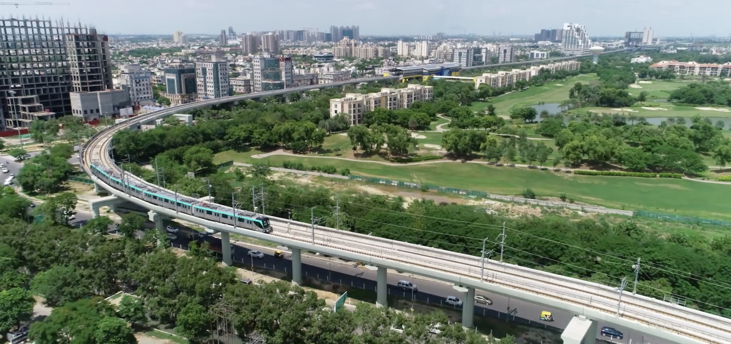
The Noida Metro’s Aqua Line route from Sector 76 to Sector 142 takes a rather bizarre path, meandering along the irrigation canal and skipping high-density clusters that actually need the Metro, while also reducing coverage and accessibility for people living on the other side of the canal.
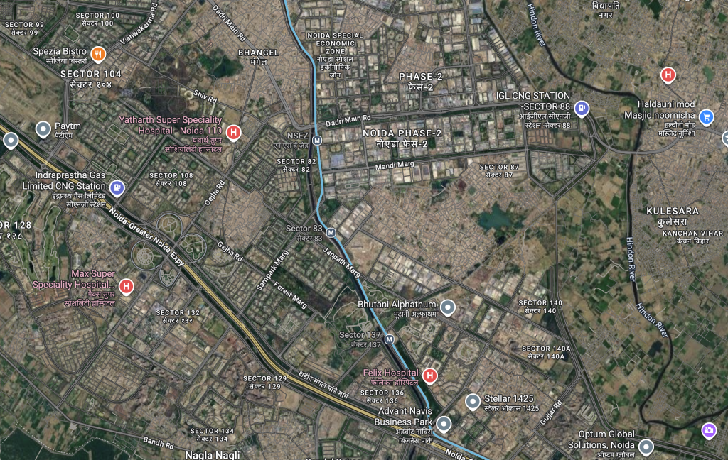
The stations are also haphazardly placed adjacent to the water body, and the only access to them from the other side is through a couple of narrow bridges along the route. It also makes it harder to fix this with feeder buses, as there aren’t enough bridges for them to cross and reach the other side. This limits the catchment area and makes the Metro less accessible to potential passengers.

The recent 21% uptick in ridership of Noida Metro has been due to the fact that it now seamlessly connects with Delhi Metro via a skywalk. In my view, if authorities can come up with a similar plan, building pedestrian-only bridges connecting the Metro stations to the other side of the canal could further increase ridership.
Chennai Green Line
The second bad route alignment I have often seen in many Metro systems in India is having too many curves or turns, and Chennai’s Green Line route around Koyambedu is a good example of this.
A novice might mistake this for a tram line rather than a Metro line, because it takes 7 turns in a span of a few kilometers. So much so that it even puts the upcoming Thane and the current Gurgaon Rapid Metro to shame, which are actually considered light rail or light Metro.
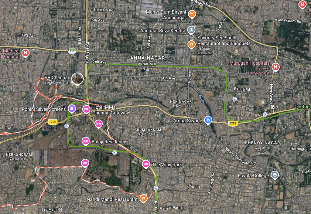
Riders have been complaining of slower speeds, jerks and screeching noise on this stretch. The tracks along the curves have faced higher wear and tear, and Chennai Metro Rail Limited has been regularly lubricating them and taking advice from Delhi Metro to address the issue. What’s worse is that in Phase 2, sharp curves are present for 16 km(for the entire network), compared to just 4.9 km in Phase 1.
Bengaluru Blue line
The long-delayed and upcoming Blue Line could have been designed to cater to the residential and commercial clusters of HSR Layout instead of routing it via the Outer Ring Road.
The roads in the area are wide enough to support Metro pillars. Alternatively, an underground option could have been explored, since the tracks have to anyway go underground beneath the adjoining defence area(there is already a precedence of metro tracks being under defence land in other cities).
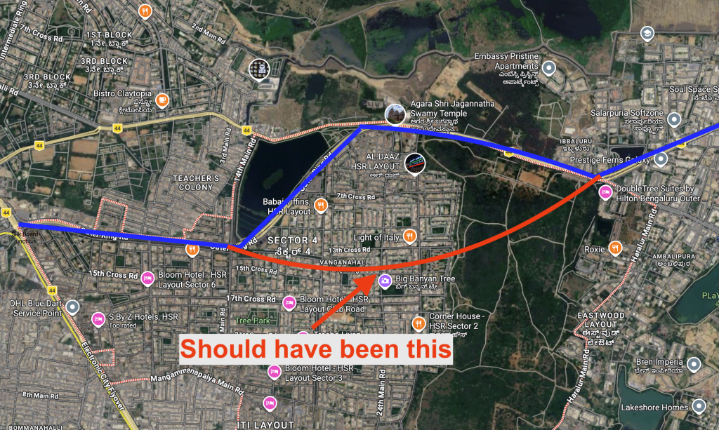
The current route via Outer Ring Road has a lake and army area on one side for almost 4 km, reducing the catchment area. Plus, the location of the stations makes it inaccessible for residents of HSR Layout, who will have to depend on a needless feeder bus to reach their homes.
HSR layout could have also supported Transit oriented development ensuring more housing and mixed use.
What’s actually going on
Cost saving measures
The reason why Indian Metro lines use arterial roads to erect pillars is to save money, as land is expensive and, in some cases, tunneling is harder due to geography, and it makes sense in a lot of cases. Seattle’s decision to go for underground in city center has been criticized due to ballooning costs and lack of consideration to alternatives like, more elevated sections.
That said, lines in our cities go underground as an exception, and not out of necessity to cater to the urban areas where people live and work. Since most Metro agencies are not landowners and lack decisive spatial policy, they are heavily reliant on fares to make up the bulk of their revenue. This is not isolated to India, even metro lines like the ones in Doha and Istanbul’s M4 metro line suffer from the same problem.
Its seen as an engineering challenge
Metro systems have historically been treated and viewed primarily as engineering challenges rather than urban planning tools. This creates a situation where, as long as a line is built on the ground and on time, it is considered a success, rather than thinking about whether it actually weaves into the urban fabric. The low initial ridership even when there are 1-2 lines is result of this strategy.
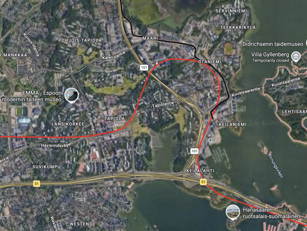
To compare, Helsinki, Finland, with a population of over a million, has 2 Metro lines but carries around 90 million passengers a year. One of the reasons for its success is how it has designed its lines. A great example is the deviation towards Otaniemi to cater to a high-density urban cluster instead of choosing the easy option of skipping it, and going straight towards Tapiola instead.
Why getting alignments right is essential
Once a line is built, it stays that way for more than a hundred years. European cities have Metro lines that date back to the late 1800s. Building a new line is getting increasingly expensive and time-consuming, making it crucial to get it right the first time to ensure a greater impact on the city and its residents.
A badly designed route can do more harm than good, with higher maintenance costs, slower speeds, poor passenger experience, and its failure to reduce dependency on private vehicles. It reminds me of the old adage, “penny wise, pound foolish.” In trying to save costs today, we risk creating long-term pain.
And the irony is that we have the funds, considering how much we spend on tunnels and elevated roads; the priority should be to allocate more of that spending towards better-aligned Metro routes.